
Dorset, January 2022.
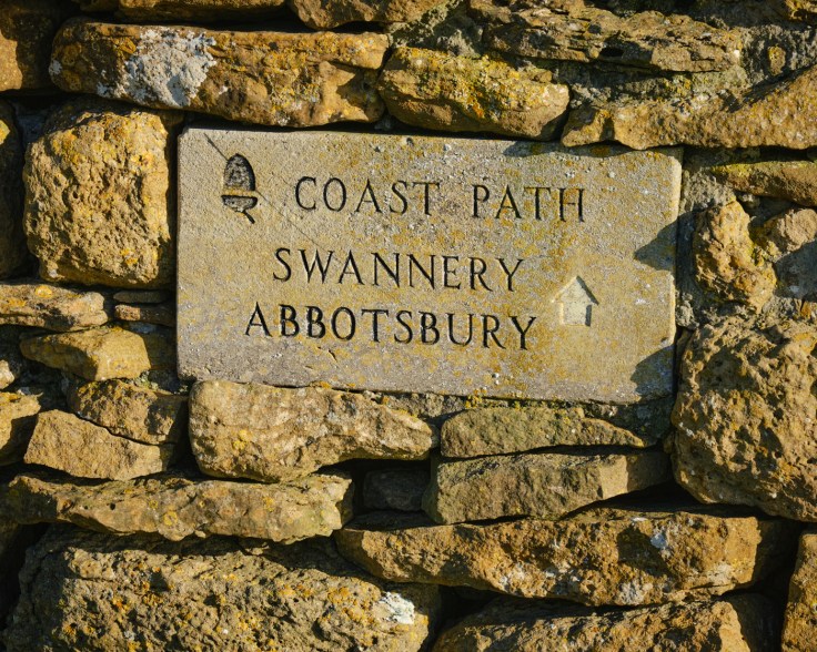
A splendid walk of 6.4 miles, which starts in the historic village Abbotsbury, follows the South Dorset Ridgeway with great views of the coast and surrounding countryside, descending back to the coast and Chesil Beach before returning to Abbotsbury.
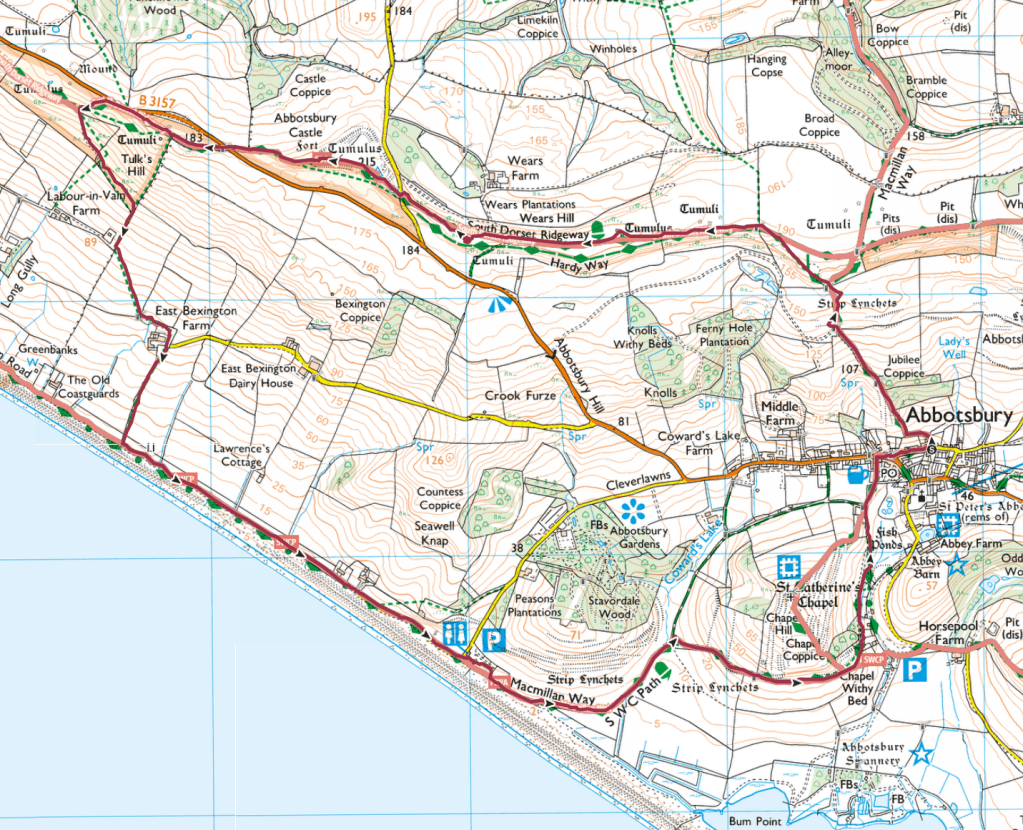
Route Map and elevation changes
Walk statistics
Weather – dry, clear blue skies, cold start, getting milder as walk progressed.
| Distance | 6.4 miles | Time walking | 2 hr 30 mins | Average pace | 2.5 mph |
| Ascent | 709 ft | Highest point | 689 ft | Lowest point | 20 ft |
| Flat section | 3.8 miles | Uphill section | 1.4 miles | Downhill section | 1.2 miles |
Photography information
All photographs were captured using a Fujifilm XT3 and two lenses; a Fujifilm XF 18-60 F4 and Fujifilm XF 55-200 F3.5 – F4.8. Images were processed in CaptureOne Pro starting with the Astia (Soft) Fuji film simulation.
Walk Description
This lovely walk starts from Back Street, in the historic village of Abbotsbury. Although there is unrestricted parking in this narrow lane I was fortunate to find a space. I doubt this would have been possible in high days or holidays as this is a favoured tourist destination. There is quite a large public car park nearby.
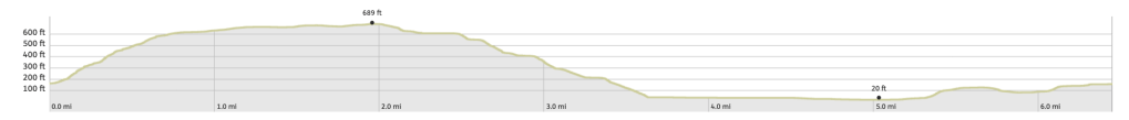
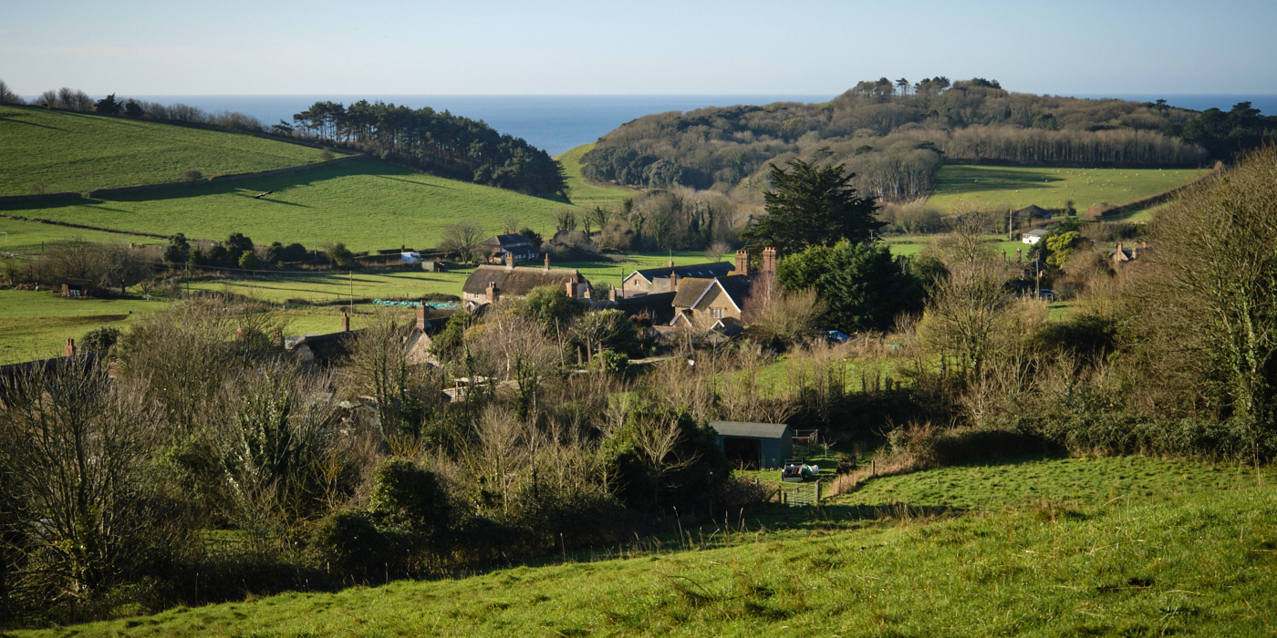
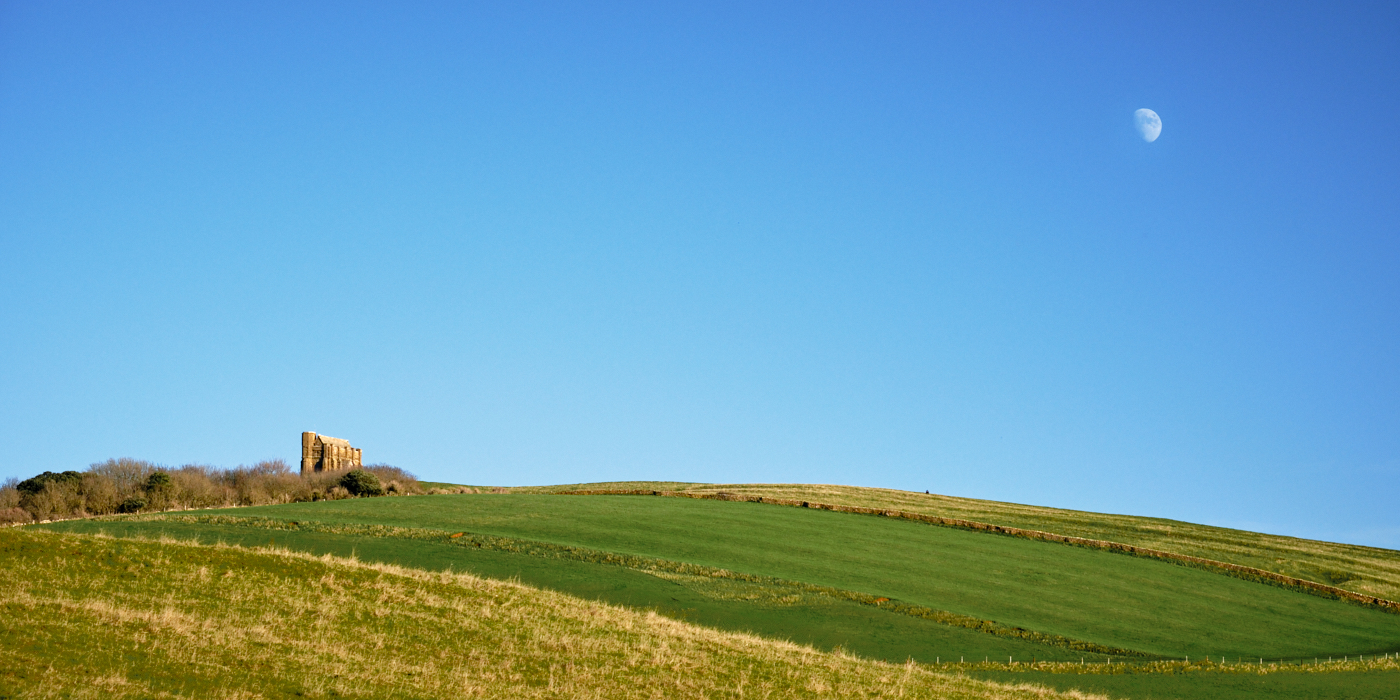
The start of the route from the road is well signposted and I climbed the path up towards the South Dorset Ridgeway. Quite muddy and slippery but more than worth the effort given the views which opened up as I looked back over the village rooftops towards St Catherine’s Chapel and the coast.
I was soon joined by a group of ramblers, and realised this was a popular route, hardly surprising given the location and it was such a beautiful winters day.
Chattering away I let them overtake me. I much prefer to be on my own and not in front of or closely following anyone else. This has nothing to do with ‘social distancing’ regulations of recent times, but other folk are a distraction and I want to enjoy the surroundings not the company of strangers.
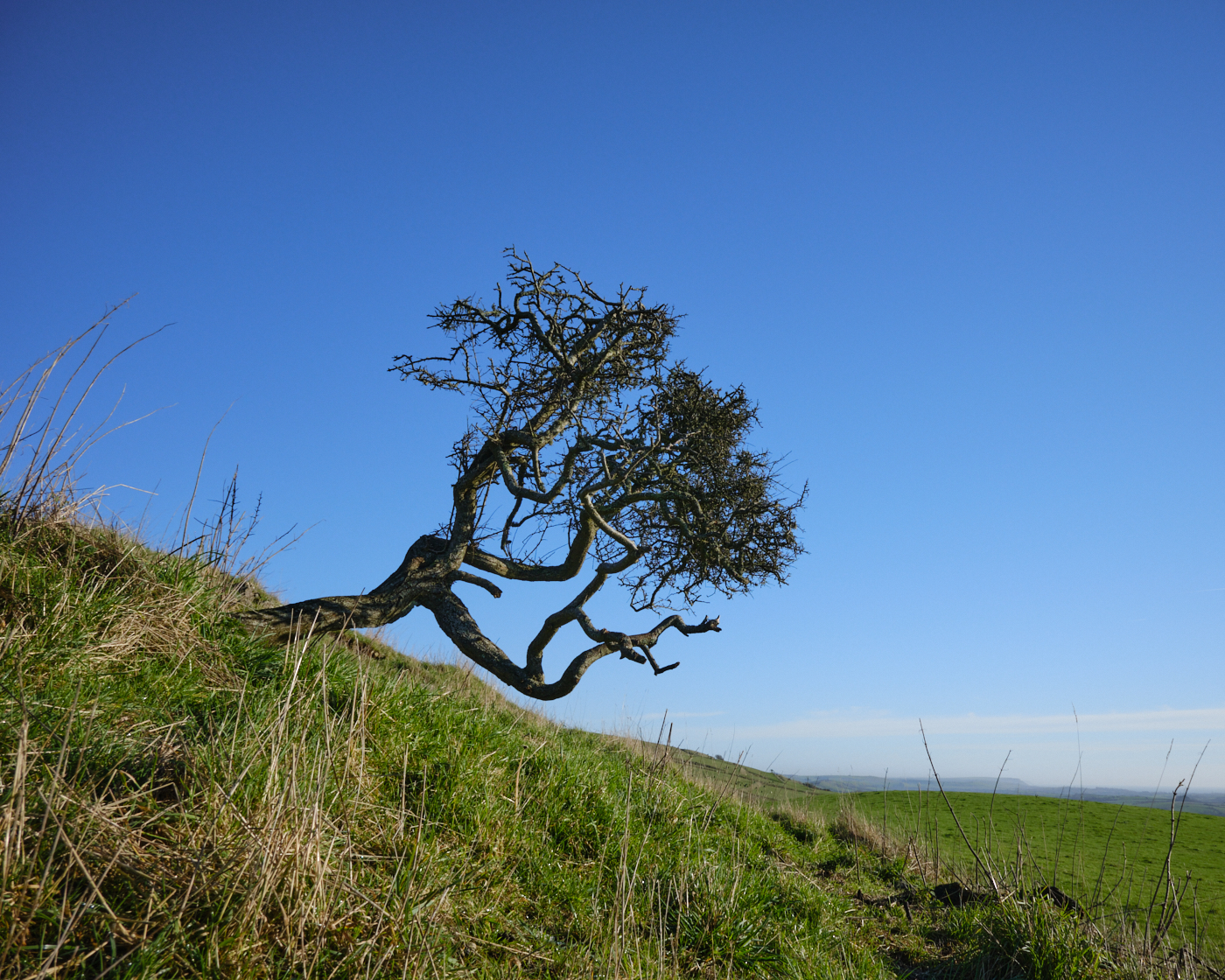
The ridgeway path follows the spine of the hill with panoramic views of the coast but also stretching inland. On reaching the beacon I stopped to have a drink and absorb what is perhaps one of the most iconic views in Dorset.
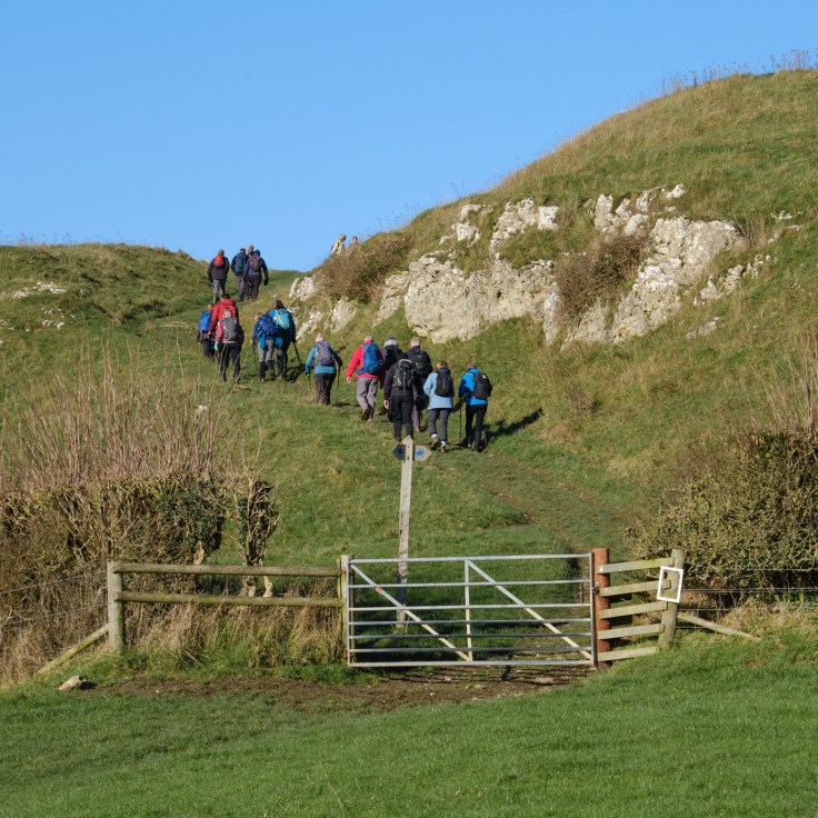
Looking east the silhouette of St Catherine’s Chapel and its long shadow is the focal point whilst in the distance West Fleet Lagoon and Chesil Beach stretch out to the Isle of Portland. Photographically I could argue this is a late afternoon shot but it’s such a wonderful scene, and for mid January the weather couldn’t have been more favourable.
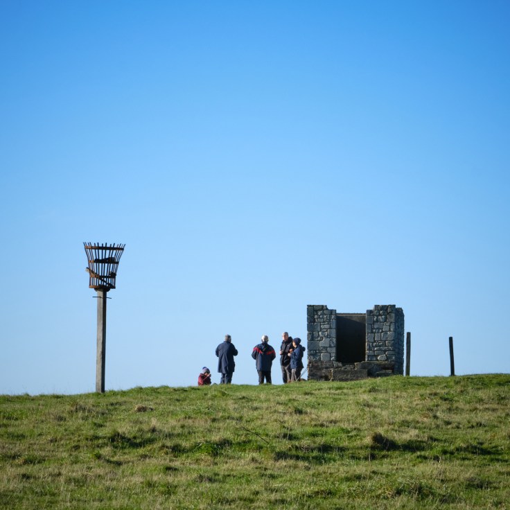
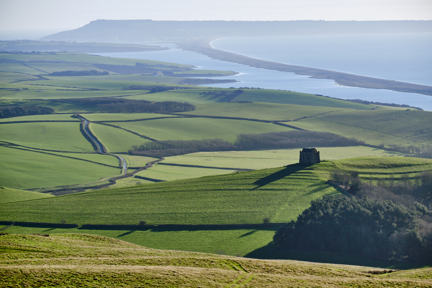
The path continues along the ridge towards the site of Abbotsbury Castle. The original castle burnt down in 1913 and its replacement was demolished in 1934.
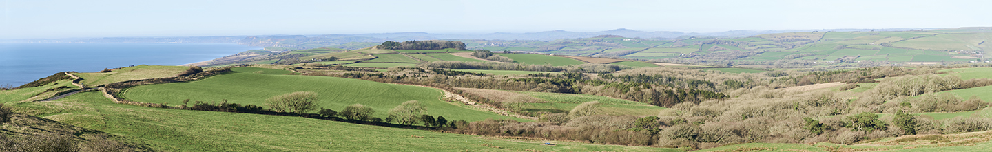
It was from this position thatI took a panorama, made up of five hand held exposures before stitching them together in CaptureOne. I have to say I am very pleased with the result even if it doesn’t show that well here.
Before crossing the ‘B’ road another group of ramblers coming in the opposite direction arrived at the stile. I gave way to them but I did say hello as they walked past me. All of retirement age, (although I am no youngster myself!) one person asked me which way I was heading. I told him but he warned me they had come that way and sections of the path were ‘knee deep’ in mud. I slight exaggeration I thought to myself.
I had to decide whether or not to stick to my chosen route or take a detour to West Bexington. I estimated this option would extend the length of the walk by a couple of miles, so I stuck to my original path and fortunately not to the mud! Yes it was slippery but it was passable with care. I did think a pair of walking poles would have provided some extra stability.
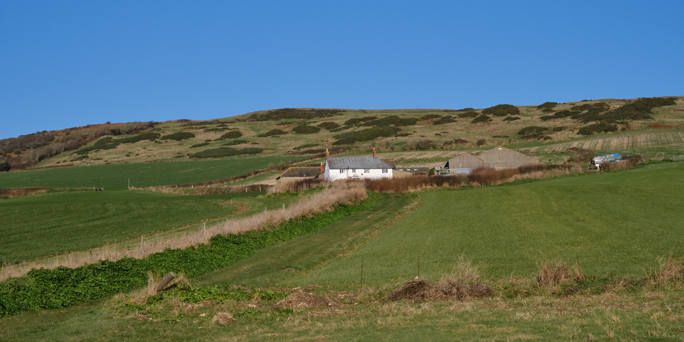
This section of the route was of course all downhill, initially the path was through an area of thicket and brambles, before opening up in the approach towards East Bexington Farm.
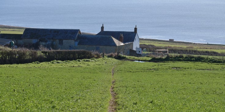
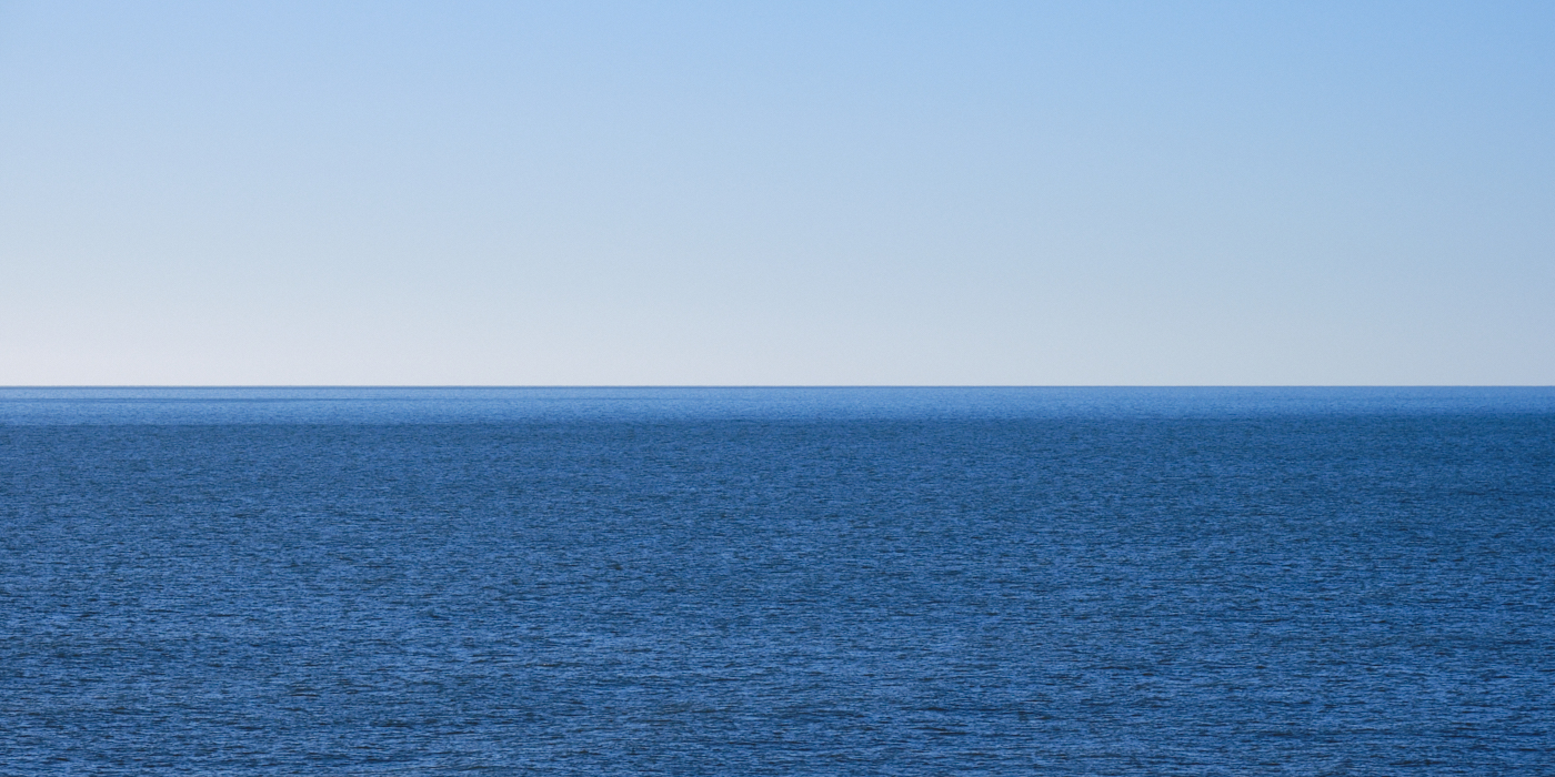
The track passes through the farm itself before joining another path which leads down to Chesil Beach. It was lunchtime and time to sit down on the shingle and enjoy the view. There wasn’t a cloud in the sky and the colour of the water….well I could have been looking out across the Mediterranean. Very relaxing and serene.
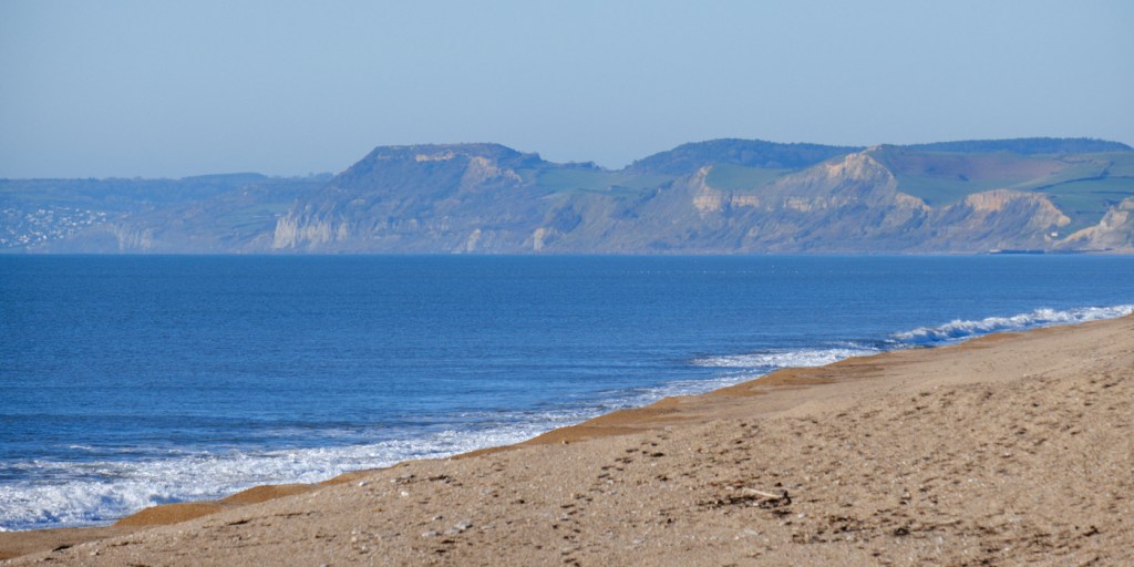
After a light packed lunch I could either walk along the beach or use Burton Road which runs parallel to the beach and is much easier going than wading through the shingle. There is little or no traffic using what may even be a private road, so tarmac won the day.
At the end of this road I arrived at Chesil Beach car park. There is a small cafe and public loos here, but I marched on having to rejoin the beach before heading back inland towards St Catherine’s Chapel.
A selection of images on the route back to Abbotsbury.
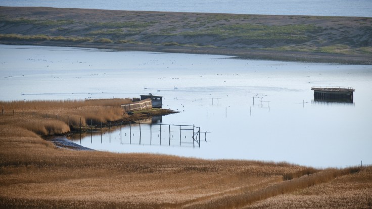
I was nearly back at Abbotsbury following a section of the South West Coast path. There were views towards Abbotsbury Swannery and the West Fleet Lagoon; a haven for wildlife, particularly migrating wild fowl and waders.
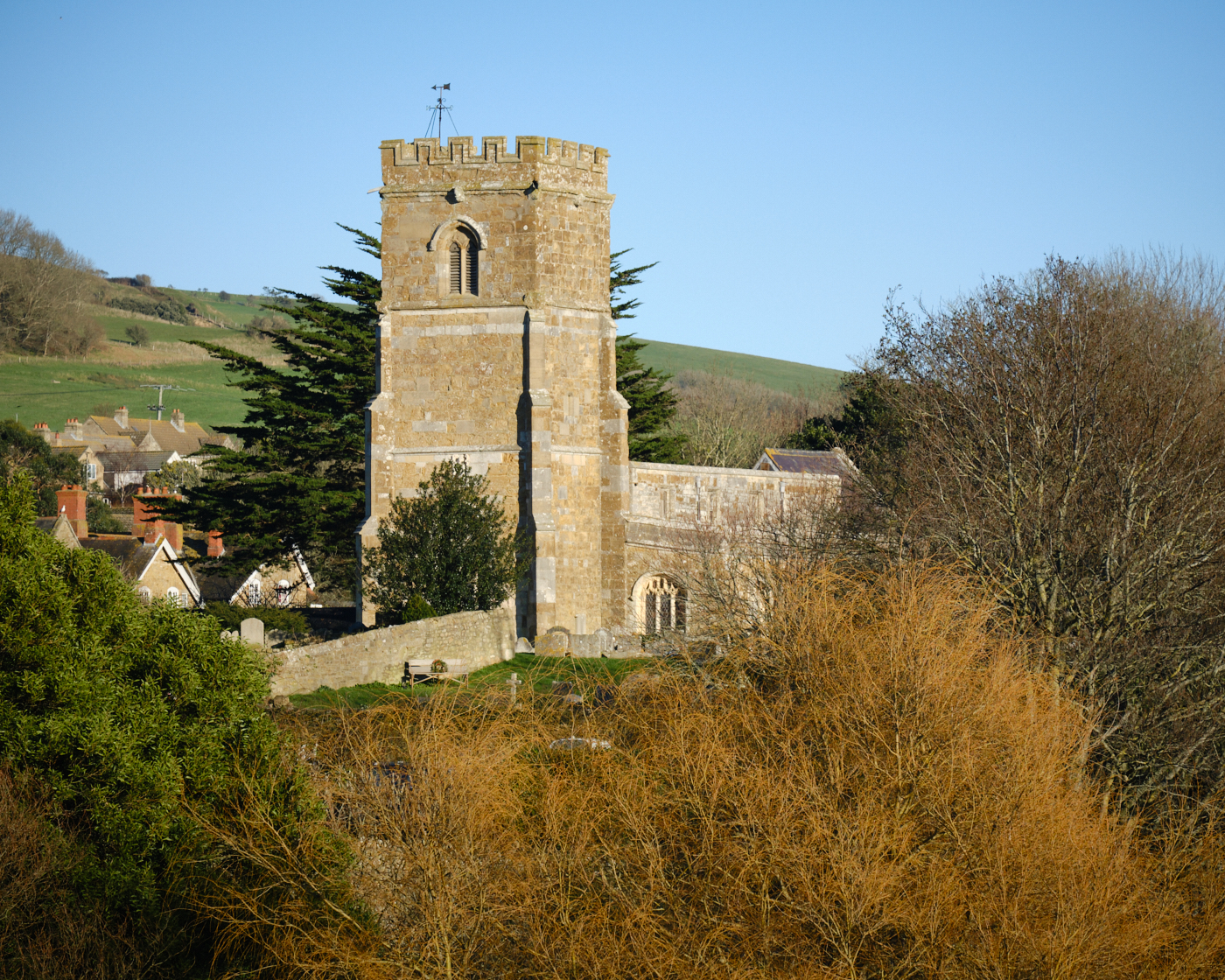
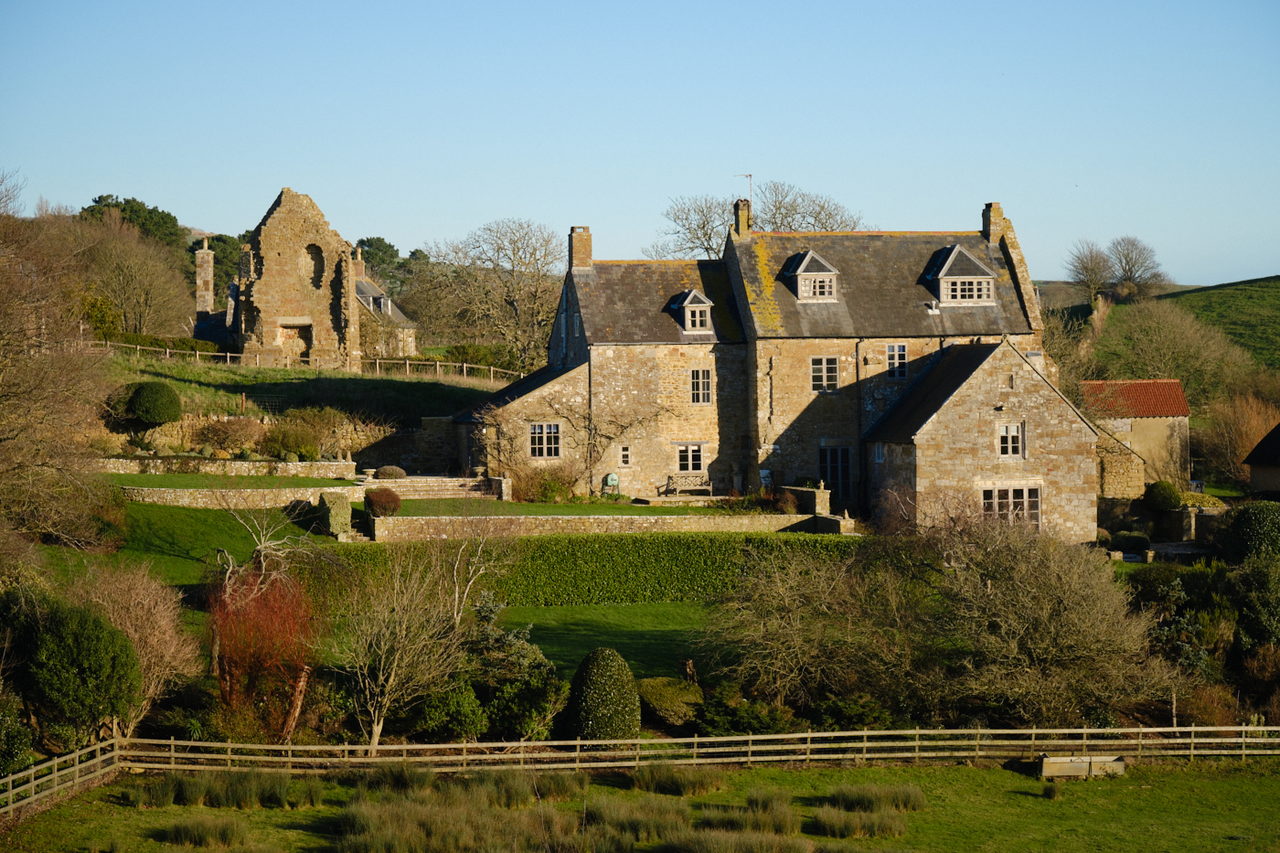
I could have taken a short detour up the hill to take a closer look at the Chapel, but I have been there before so decided to give it a miss on this occasion. Although I am reasonably fit it has been a little while since I walked this far in one go so I was ready to complete the walk. Approaching the village, there were good views of St Nicholas Church, the Manor House and the remains of the Benedictine Abbey dating back to 1044.
At the junction of the footpath and West Street there is a rather well stocked convenience store. It may have been January but I couldn’t resist devouring a small tub of honeycomb ice cream.
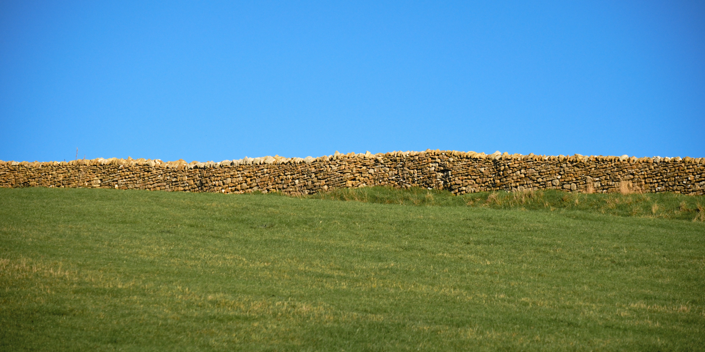
It was only afterwards that I thought the flavour reflected the honey coloured stone so typical of the village cottages and boundary walls.
Finally back to the car and the end of a truly excellent walk.
Thoughts
Abbotsbury is truly a picture postcard and historic village. I could easily have spent more time wandering around the village itself as well as writing more about it here, but instead you might just want to click on the link and explore the village website for yourself.
I mentioned that I had visited St Catherine’s Chapel previously and there are more images of the chapel and the church on my photography website.
As for the route itself I was faced with a fairly steep climb out of the village before having any chance of warming up. If I was to repeat the walk I think I would do it in reverse, by heading down to the coast, along Chesil Beach and then climb up onto the ridgeway. In other words clockwise instead of anticlockwise. I would also give more consideration to the time of day to make the most of the directional light from a photographic point of view.
I was carrying a backpack and probably too much camera gear, as I never know what I might need but I do think I could cut back a little and save some weight.
On reflection I should have taken a peaked cap as the sun was very low in the sky and walking poles would have been useful particularly for the muddy downhill section.
When planning this route I had high expectations but these were exceeded by the walk itself, no doubt helped by the exceptional weather. Hardly a cloud in the sky from start to finish.
The views along the ridgeway are far reaching and I was able to experience at first hand the true beauty of the Jurassic coastline and Dorset countryside. I am already looking forward to the next outing with eager anticipation.
So until next time, Happy Walking.

Leave a comment